
Missionary map
LDS Missionary Map
See the area where your missionary is serving, and where every missionary your family follows is serving, on one map. A mission name becomes a place you can actually picture.
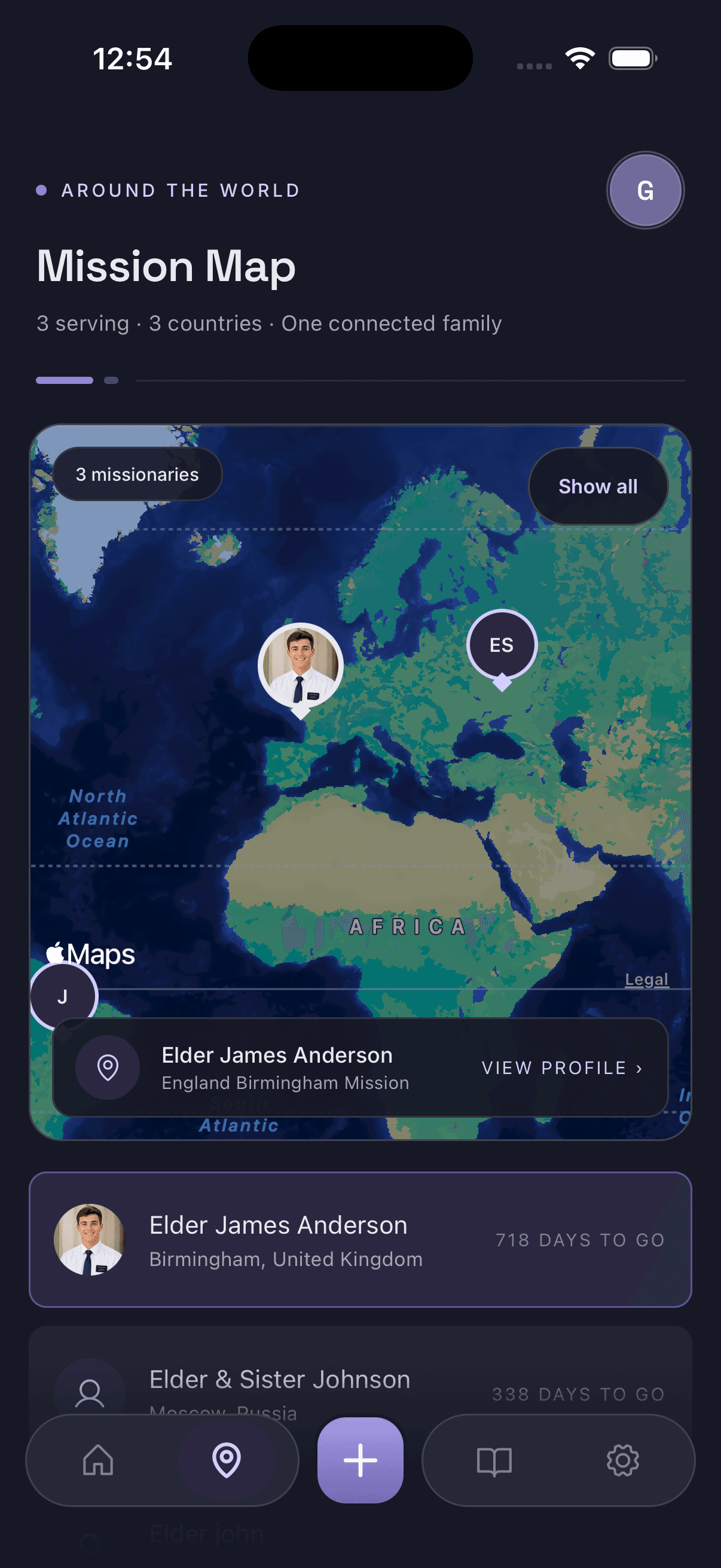
A mission name, put somewhere real
“Brazil São Paulo Mission” means very little to most families the first time they read it. The map view answers the question underneath it: where is that, and how far away is it? Each missionary you follow appears as a pin on the area they’re serving in, with their mission listed below the map. Tap a name and the map centres on them.
For grandparents especially, this tends to be the part of the app that lands. Seeing the pin sit on the far side of an ocean gives the mission a scale that dates on their own never do — and it makes the ordinary details land differently too, like knowing it is winter there while it is summer at home.
What the map gives a family
Their current area
The area recorded on the profile, shown as a pin — updated when a transfer moves them somewhere new.
Global perspective
Where the mission sits in the world, and how far it is from where you are reading this.
Everyone at once
All the missionaries you follow on one map, not one screen each.
Context for the mission
Mission name and area side by side, so the location always has a label attached.
What the map is not
This is worth being direct about, because “missionary tracker” can sound like something it is not.
Missionary Tracker does not track a missionary’s phone, and it does not show live GPS location. There is no real-time position, no movement history, and nothing a missionary has to install or leave running. The map reflects the serving area recorded on the profile by whoever manages it — the same way a family already knows which mission and which area someone has been assigned to.
That is also the point. Families want geographic perspective, not surveillance, and missionaries should be able to serve without being followed on a map.
The map alongside everything else
Location is most useful next to the rest of the mission. The same profile carries the missionary countdown — days served, days remaining and percentage complete — and an Updates tab where missionary updates and photos are shared with everyone following. The app also shows the local time and weather in their area, which is the natural companion to a pin on a map.
Start from the Missionary Tracker home page for the overview, or see the complete feature list.
Missionary map questions
Does the missionary map show live GPS location?
No. The map shows the area a missionary is assigned to, based on the mission and area recorded on their profile. It does not track a phone, it does not follow anyone in real time, and it does not show a precise position.
Can I see more than one missionary on the map?
Yes. Every missionary you follow appears on the same map view, each with a pin and their mission listed underneath. Tapping a name centres the map on that missionary.
Who updates the area shown on the map?
Whoever manages the missionary's profile. When a transfer happens, the area on the profile is updated and everyone following that missionary sees the new location.
Do followers need their own copy of the information?
No. The map reflects the shared profile, so family members who joined with the join code see the same locations as the person who created it.
See their journey in Missionary Tracker
Put every missionary your family follows on one map, with the countdown and updates on the same profile.
Free to download on iPhone and Android.